TAS day 23: Lake St Clair to Queenstown
January 18, 2016. 93km.
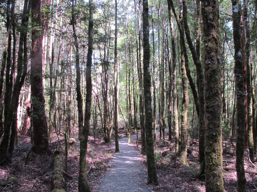
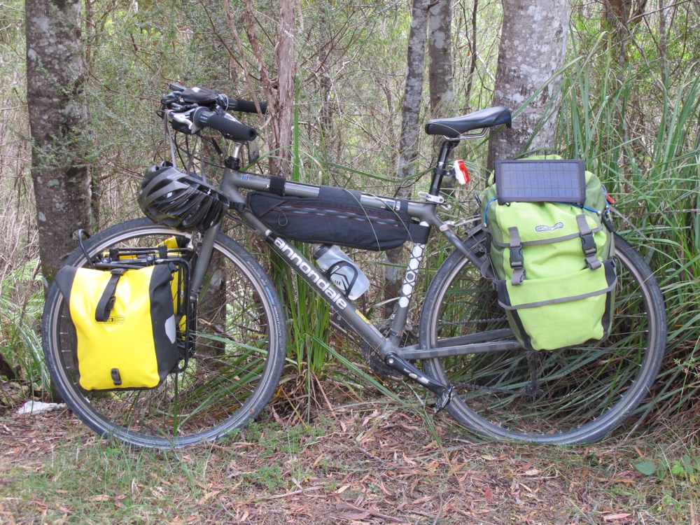
Today was, I think, the best day of bicycling so far. The west half of Tasmania is far from flat, but the scenery is amazing. Most of the ride today was in the Franklin-Gordon Wild Rivers National Park, with no stores or settlement after Derwent Bridge (right at the beginning). As with the last couple days, there were very very few cars, and the people driving the few cars were mostly really friendly. Lots of people waving, almost all passing politely.
After a tasty breakfast at the park cafe (I don’t even want to think about just how much money they got from me on food the last couple days) I biked the 5km gently downhill back to Derwent Bridge and the main road. I stopped at the small shop to grab a couple things, and overheard the cashier telling another customer that they had evacuated cradle mountain (‘4 hours from here’) due to a bushfire. It will take me a good deal more than 4 hours to get there, but that’s something I’ll need to keep an eye on.
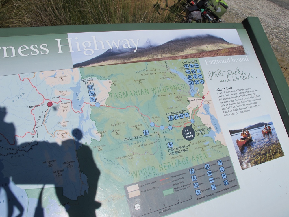
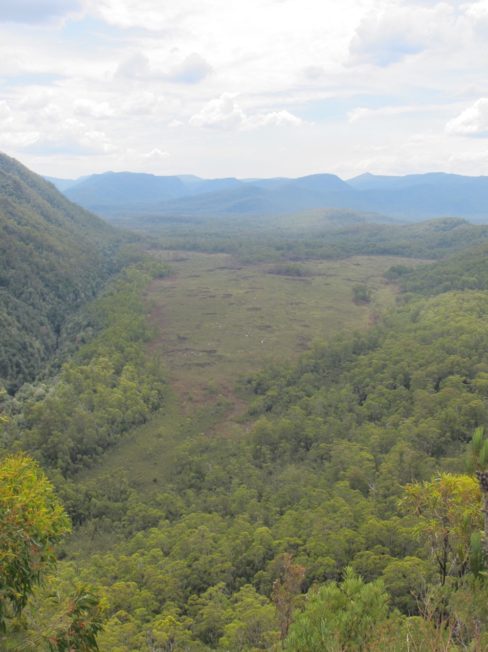
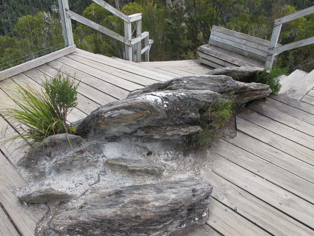
The first part of the day was gently undulating along through buttongrass and eucalyptus, with rugged peaks in the distance all around. It’s hard to really do the drama of the landscape justice with my photography skills. It’s really quite amazing. Not long into the day, there was a viewpoint pull off with a sign describing the various stops and hikes along the highway. I ended up stopping at all of the open ones (the last, a waterfall was closed for upgrades to path and toilets) and they were all worth it. This was one day I was glad to be going clockwise around the island. Though there was substantial climbing (over 1000 meters according to the internet), the overall trend was downhill and that made it all that much easier to enjoy the scenery and find the time for the short hikes at the various stops.
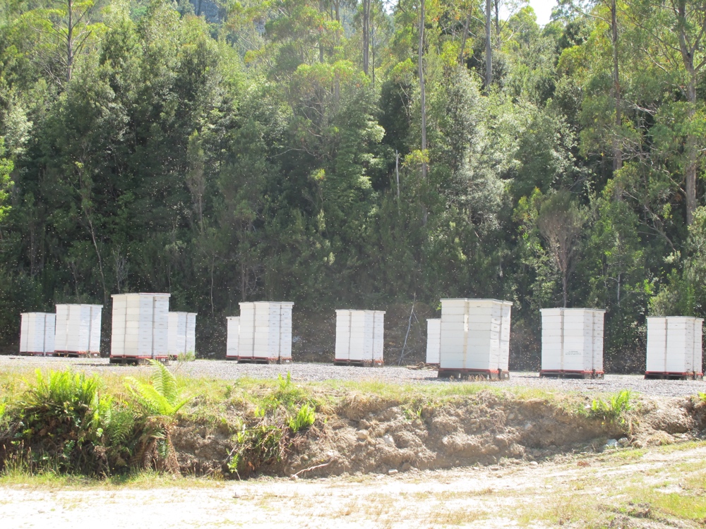
Along the highway I started to notice quite a lot of beehives. I learned later that during this time of year the only thing flowering in the forests here is the leatherwood tree, and all the bees get trucked in to make leatherwood honey.
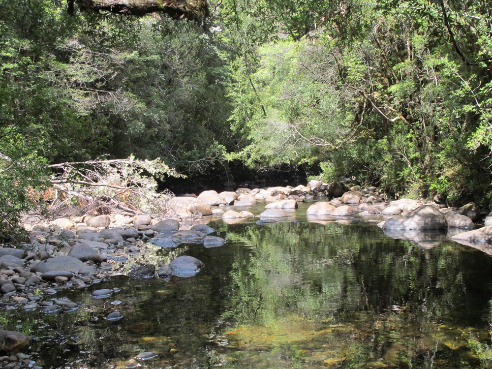
The first of the day’s side trips was a short walk to the Franklin River. It was a nice jaunt, but probably the least impressive of the three stops. I did appreciate seeing more water though. After the east coast, it’s nice to not have everything feel so dry.
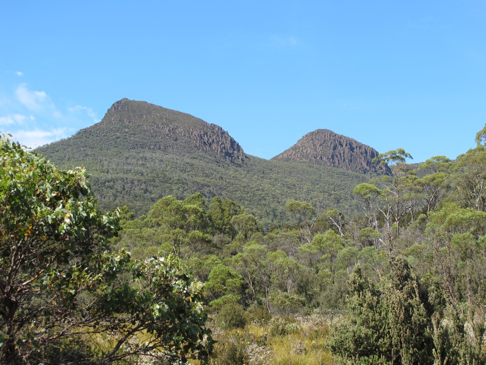
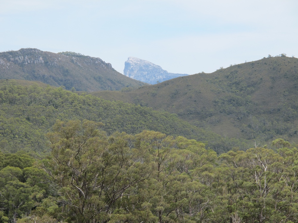
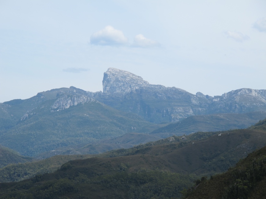
After this short walk it was onwards toward the Frenchman’s Cap walking trail. Frenchman’s Cap is the rather distinctive mountain visible through much of today that is white and sticks up like… a cap, I guess.
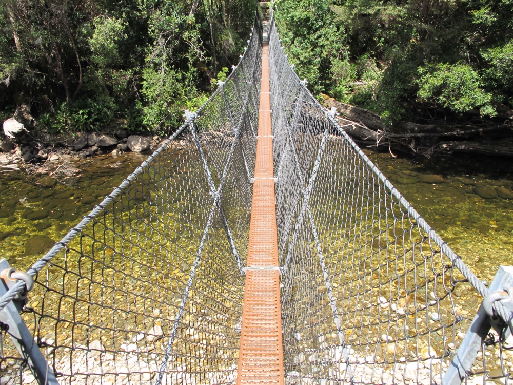
Apparently hiking to the top of the Cap is a multi day affair that involves 5km of slogging through swamp with knee (sometimes thigh) deep mud. Doesn’t sound like fun to me, but I suppose it’s an accomplishment. For us wimps, the first 10 minutes of the trail gets you to a swing bridge over the river which is rather fun to cross.
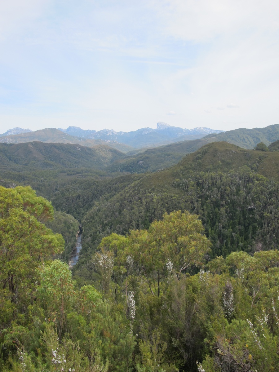
The last hiking stop of the day was also the longest and most dramatic. There is a 20 minute hike up a rather steep path, but in the end you get a panaramic view around the whole area. The day was clear, and the views were breathtaking.
After absorbing the views I wandered back down the trail snacking on TamTams and got back on the bike.
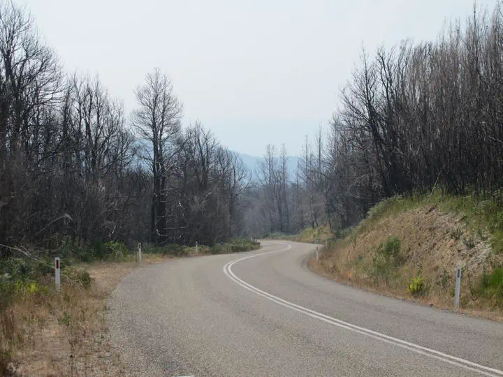
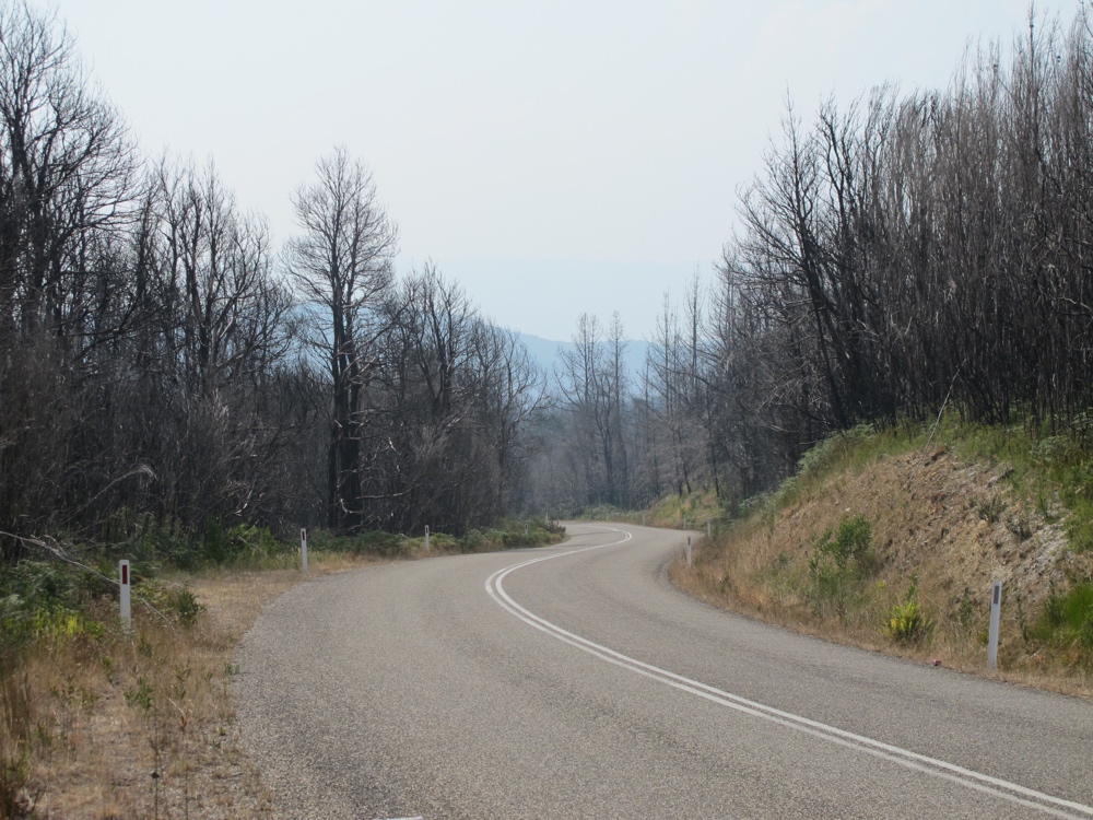
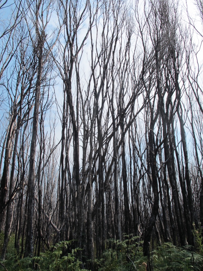
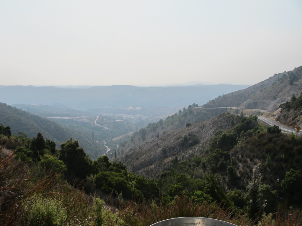
Just as I was starting to get frustrated with how much uphill I had to do on a nominally downhill day, I got the long sweeping descent out of the highlands and down into the relative lowlands of the Lake Burbury area. Down in the valley it got rather dramatically smoky from some combination of all the various bushfires (none too close) and the wind. Apparently Hobart was pretty smoky today too. Though I didn’t bike thorough an actual fire, I did go through an area that had clearly had a fire not too terribly long ago. It was pretty spooky, actually.
The smoke got heavier as I approached Lake Burbury. There’s a cheap camping area at the lake, but I gather it doesn’t supply drinking water (I could have probably filtered lake water) and I wanted to push on to Queenstown so that I could do the tourist railroad the next morning. Besides, the lake area was too smoky for my tastes. Biking over the bridge across the lake was extremely dramatic, though, with burnt areas and smoke and the lake itself. Unfortunately there wasn’t a safe place to stop for picture taking.
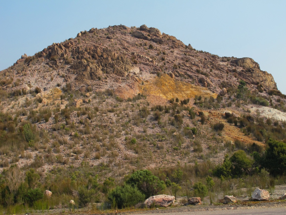
It was only a dozen or so km more to Queenstown but there was a doozy of a hill (I knew it was coming, but after 80km of riding it was a hard one). Coming up over the hill to Queenstown the scenery changed dramatically. The town is a mining town – gold, then copper and some silver. All the smelting that went on apparently killed all the vegetation, and then without the trees all the soil eroded. So the hills around Queenstown are bare rock and minerals. The colors are quite pretty, if you ignore the fact they were caused by poison, basically.
Queenstown itself is a cute town, even though it’s still an active mining town. And I certainly wouldn’t want to drink out of the creeks flowing around here (most have a sign saying not to, anyway). I got a motel room for the night, and ate dinner for the grocery store since I had been eating at the park restaurant for the last few days for every meal.